Super Cyclone ‘Yash’ might hit at weekend
The meteorological department is not sure about the direction and the speed of the wind but they said that a low depression has been formed and as it is increasing in strength every day it might take the shape of a 'Super Cyclone' before making landfall by the end of the week.
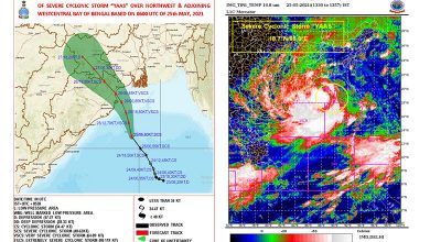
Kolkata : The Regional Meteorological Department has predicted that Super Cyclone ‘Yash’ is likely to make landfall in Sundarban areas between May 23 and May 25 and possibly move towards Bangladesh.
The met department warned that the ferocity of the cyclonic Storm named by Oman might equal that of ‘Amphan’ that devastated Kolkata and adjoining areas on May 19 last year during the lockdown.
Though the meteorological department is not sure about the direction and the speed of the wind but they said that a low depression has been formed in the East Central Bay and its adjoining areas and as it is increasing in strength every day it might take the shape of a ‘Super Cyclone’ before making landfall by the end of the week.
However, the officials are of the opinion that the storm might move towards Bangladesh after entering land through the Sundarbans. The department has already issued a warning to the fishermen asking them not to venture to the sea on May 23.


The department officials said that because of the formation of the depression, temperature is increasing in the areas of Gangetic West Bengal including Kolkata, South and North 24 parganas and it is likely to increase further. “In the last 24 hours the temperature has increased five degrees and it is likely to touch 40 degrees in the next couple of days. The humidity is also high creating uneasiness for the people. These are all results of the depression,” a met official said.
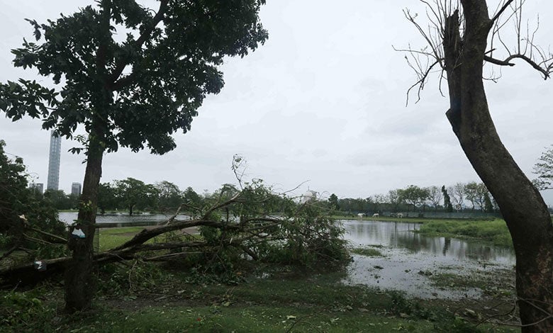
Last year Kolkata witnessed one of the most devastating cyclonic storms when ‘Amphan’ made landfall in the Sundarbans at a speed of nearly 260 kilometres per hour and went through the heart of the city, almost bringing all activity to a standstill for the next seven days.